A weak weather disturbance blowing across the Pacific Ocean might build into the next major snow event for eastern Nebraska — or it could usher in nothing more than a cloudy, gray Midwestern winter day.
Ken Dewey, professor of climatology at the University of Nebraska-Lincoln, said that while some models show 12-plus inches of snow headed for the Midwest next week, the system is simply too far away to make accurate forecasts on precipitation potential.
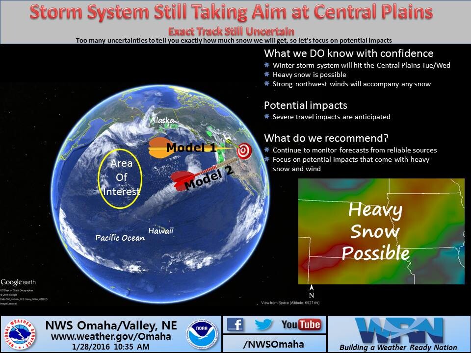
“There’s a lot of uncertainty on how this system will impact the region because it is so far out there,” Dewey said. “It was off the east coast of Japan on Wednesday and will travel to the Aleutian Islands, plunge down the west coast, then across the Rocky Mountains before it even takes aim on the Midwest.
“A wobble at any point in that path, and Lincoln could end up receiving heavy snow, rain or nothing at all.”
The forecast will become more precise after the system crosses the Rocky Mountains and turns toward the Midwest, most likely on the evening of Jan. 31.
“The analogy I like to use is to tell people to imagine they are standing in Phoenix, Ariz., then I ask them to point toward Lincoln,” Dewey said. “Then, I ask them to point toward Des Moines. That helps people realize that a shift of only a couple of degrees in the storm path can make a big impact by the time it reaches the Lincoln area.”
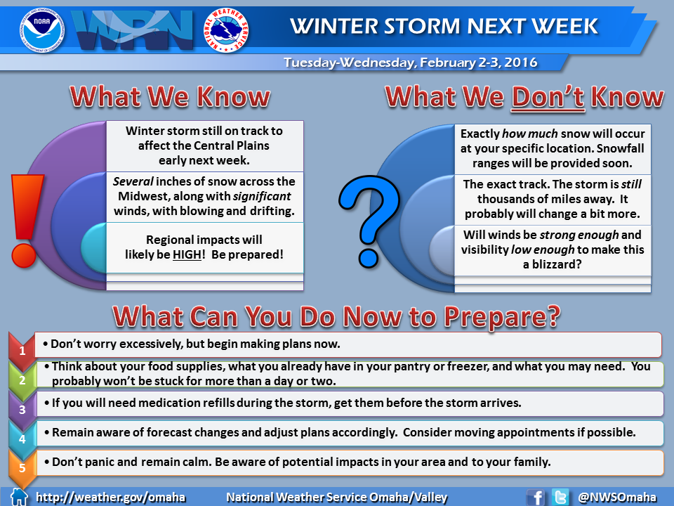
Currently, the National Weather Service is predicting a 25 percent chance of snow the afternoon of Feb. 1 with a 65 percent chance of snow late that day and into Feb 2. The forecast also calls for 25 to 30 mile per hour winds and high temperatures in the mid-20s.
“Yes, it’s too early to predict snowfall potentials with any certainty, but that doesn’t mean you should totally ignore the overall forecast,” Dewey said. “Treat these early forecasts as a ‘heads up,’ alerting you to the potential of a storm. And, be certain that you pay attention to the forecasts as the event approaches so you are aware of the exact storm path and more accurate snowfall predictions.”
For more information about current and upcoming weather predictions, Dewey said people should follow the local National Weather Service office. Dewey also makes those reports and other updates available on his Twitter feed.
UNL sends emails and text messages about weather-related closings and campus emergencies through UNL Alert. For more information about UNL Alert, including how to sign up your cell phone number, go to http://emergency.unl.edu/unlalert.
The weather-related closures are also made available on the UNL web page; Twitter accounts @UNLincoln and @UNLNews; Facebook; local radio and television stations by 5 a.m. for day classes and 2 p.m. for night classes; the university’s toll-free hotline, 1-877-848-7537; and through the university operator, 402-472-7211. For more information, click here.