Welcome to Pocket Science: a glimpse at recent research from Husker scientists and engineers. For those who want to quickly learn the “What,” “So what” and “Now what” of Husker research.

What?
Aquifers – the underground beds of porous rock or sediment that groundwater seeps through – provide drinking water and irrigation for people the world over. Though precipitation and some rivers continuously replenish aquifers, humans are depleting many aquifers faster than the groundwater can be replaced.
Given groundwater’s importance, researchers regularly attempt to estimate this so-called recharge rate. But many estimation methods struggle to generate consistent results, especially across different landscapes.
So what?
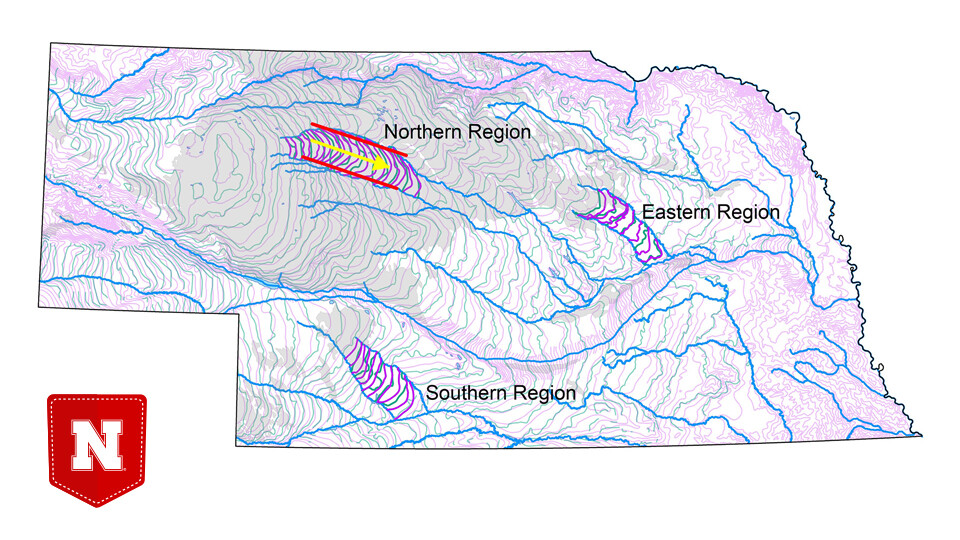
Nebraska researchers Troy Gilmore and his colleagues recently developed a simple method for estimating recharge rates in regions that are straddled by parallel streams or rivers. Three such regions sit above the High Plains Aquifer in Nebraska.

Estimates derived by the new method generally agreed with more technologically dependent estimates made at the three Nebraska sites.
Now what?
The approach could help refine preliminary estimates of recharge, evaluate the quality of water-table maps and prioritize the regions most in need of better groundwater monitoring, the researchers said.