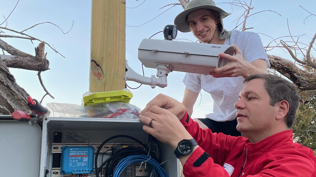
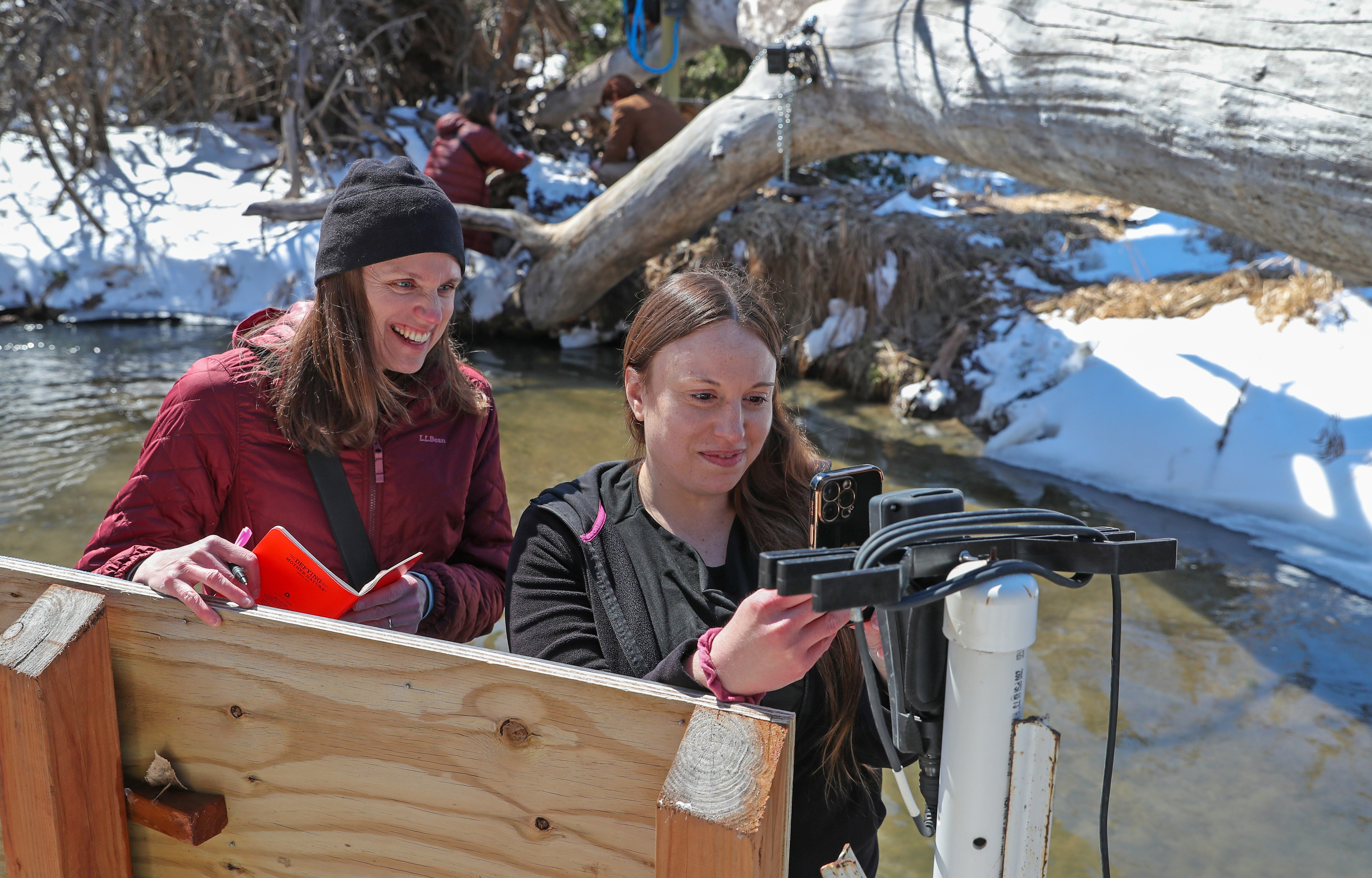
Scientists operate dozens of ground-based, time-lapse cameras to monitor water body conditions in the Platte River basin. They are among the 1,400-plus cameras monitoring the nation’s inland waterways, generating an enormous amount of visual data with great potential to boost environmental understanding.
A University of Nebraska–Lincoln and University of Nebraska at Kearney collaboration, known as the GRIME Lab, is developing software to process that avalanche of data.
Once data-management capability is achieved, scientists will have enhanced tools for environmental analysis, and the public can be better informed about factors relating to floods, ice jams, overall river conditions and water quality.
The image archives from time-lapse cameras “are rich with natural resources information, especially the dynamics of water resources and aquatic habitat, but the full value of these images is still unknown and untapped,” said Troy Gilmore, an associate professor with UNL’s School of Natural Resources and Department of Biological Systems Engineering.
Environmental scientists regularly visit lakes, rivers and streams to study their condition, but using data from time-lapse cameras “fills in those gaps between site visits and really brings out a lot of the dynamics that are happening when you’re not present,” said Gilmore, a groundwater hydrologist with the Conservation and Survey Division in the School of Natural Resources.
The GRIME Lab offers open-source software online known as GRIME2, standing for Gaugecam Remote Image Manager-Educational. The GRIME2 algorithms analyze water body imagery to automatically measure water levels by transforming image pixels to real-world values such as inches or centimeters.
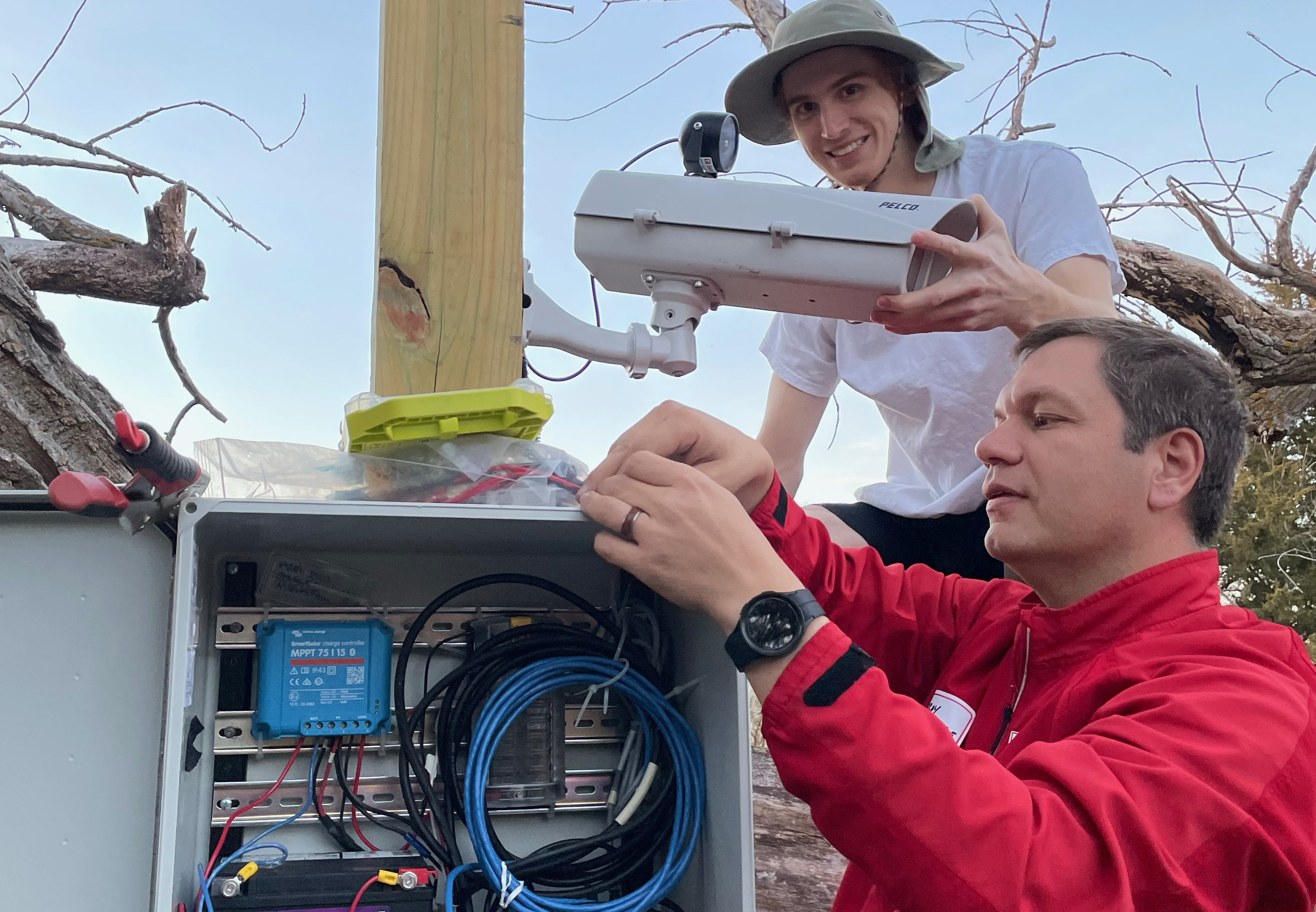
A team of software experts at Nebraska is expanding that effort via the lab’s open-source GRIME-AI software, which uses artificial intelligence and machine learning to streamline data management and image processing for ground-based imagery. This will boost efficiency and ease of use as researchers work with imagery from large archives such the Platte Basin Timelapse project, which operates about 60 cameras; the PhenoCam network, with 700 cameras nationally; and the U.S. Geological Survey’s 688-camera network.
The GRIME Lab is working to refine its AI software so it will offer scientists more advanced functionality, such as environmental modeling. The GRIME-AI system will make image-based projects easier for scientists, Gilmore said.
One goal is to make water-level measurements from the imagery at an accuracy level on par with existing sensors. Another goal is to pull additional imagery information to add to the value of data obtained by traditional sensors.

Those efforts are led by John Stranzl and Ken Chapman, nontraditional, doctoral-level experts with extensive software experience. Pavan Guggilla, a graduate research assistant in the School of Computing, joined the team this year.
The increased analytical ability made possible by these software developments will have major long-term benefits for environmental study, said Mary Harner, research professor with UNK’s Departments of Communication and Biology, who is working with Gilmore as a member of the GRIME Lab. An expert in river floodplain ecosystems, she has carried out extensive scientific study in the Platte River basin in central Nebraska.
When water boundaries change or fluctuate, the intersection of water and land changes, Harner said, and that has many implications for biological and ecosystem processes and the availability of habitat. By quantifying and digitizing changing water-body conditions, she said, the GRIME Lab can strengthen the understanding of environmental changes affecting a wide range of aquatic and land-based organisms.
The GRIME Lab is a multidisciplinary endeavor.
“It really relies on bringing knowledge, skills and expertise from different fields to be able to do some of the more complex things,” Harner said.
Undergraduate students from a range of academic backgrounds have opportunities to participate in the project. As part of the GRIME Lab work, UNK students help with camera and marker installation at the Kearney Outdoor Learning Area, near a channel of the Platte River. All students are learning about ecohydrology and the software development life cycle through planning, developing, testing and using the software.
“Some students are on the advanced side, and some are on the beginning side,” Harner said. “So, we have workflows and processes so people can enter where they’re at and learn and grow.”
Gilmore has a network of U.S. contacts with an interest in the GRIME Lab’s work, and many of those scientists are partners for the project.
“They’re coming with their own questions that are inspiring some of the software features to prioritize,” Harner said.
The project is still in an early stage, but as advanced software functions are made accessible, the long-range possibilities are encouraging.
“If we can get these tools built,” Gilmore said, “it really opens up opportunities to answer a long and growing list of scientific questions.”
Share
News Release Contact(s)
Tags
High Resolution Photos
HIGH RESOLUTION PHOTOS
HIGH RESOLUTION PHOTOS