Following another year of above-average precipitation, Nebraska groundwater levels continued to rise in the areas most affected by the 2012 drought, according to a new report from the University of Nebraska–Lincoln’s Conservation and Survey Division. Still, some portions of the state recorded levels below those of the pre-drought years.
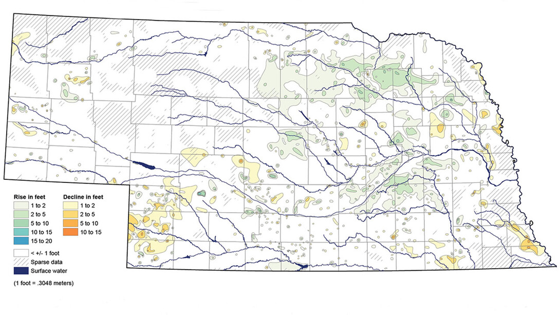
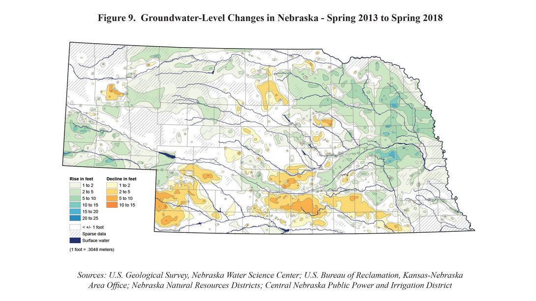
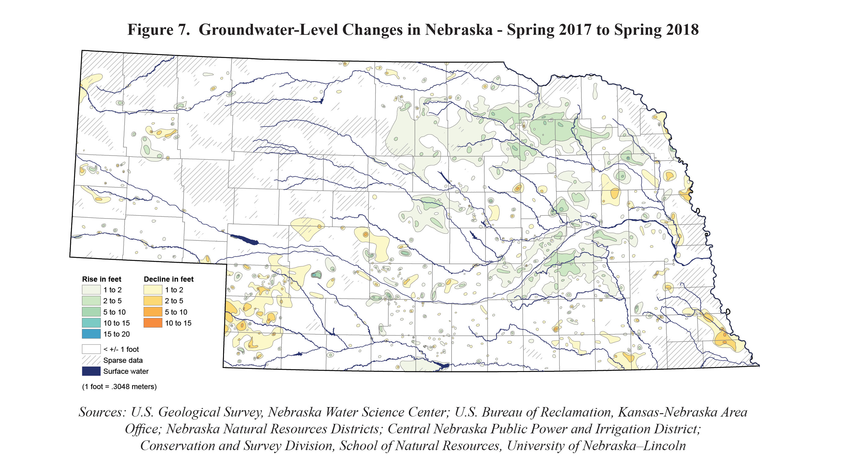
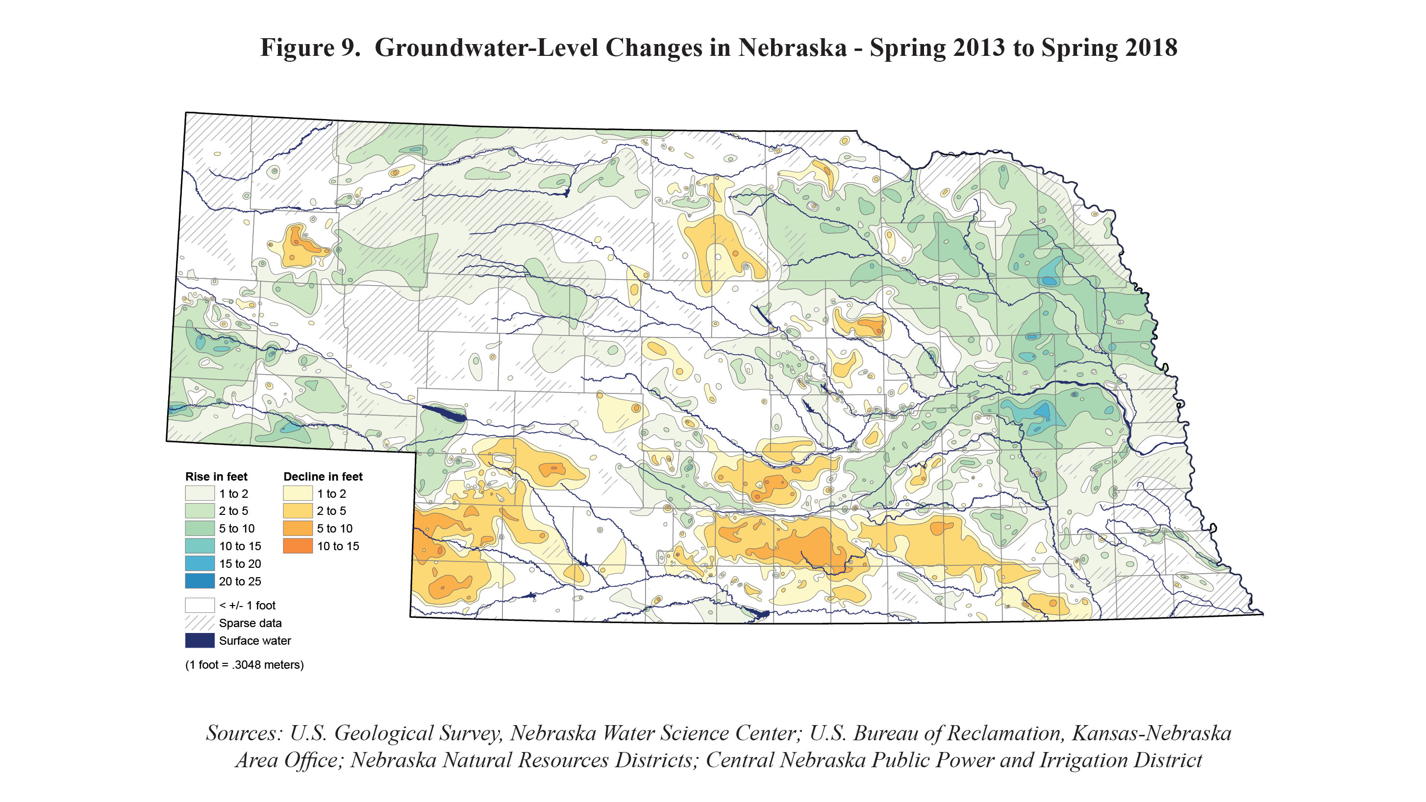
The annual statewide report, part of a nation-leading groundwater-monitoring program, examines short-term groundwater rises and declines measured in 5,365 regional wells from spring 2017 to spring 2018. It also looks at long-term trends since monitoring began in the 1930s.
“The one-year change maps really aren’t the ones that are the most important,” said Aaron Young, survey geologist and lead author of the report. “It’s the long-term trends that illustrate the lasting effects of both our conservation measures and our water use.”
The long-term trends show both rises and declines in groundwater levels when compared to pre-development records. The greatest declines, of about 122 feet, were recorded in western Nebraska, particularly in areas with high irrigation-well densities in aquifers that have little or no connection with surface water and where annual precipitation is limited. The largest rises, of up to 120 feet, were recorded in counties in south-central, central and western Nebraska, where extensive canals and surface-water irrigation systems seep into the aquifer.
In addition to human-driven changes that alter the water levels, changes in precipitation have an effect.
“Nebraska has an excellent system in place to monitor and react to groundwater-level trends and prevent problems,” Young said.
It is that system that helped portions of eastern and central Nebraska, which once had rapidly declining water levels, stabilize and in some cases begin to recover.
In-depth maps in the report give visual representations of all of these changes over time, providing the information in one-year, five-year, 10-year and since-pre-irrigation (about 1950) increments. The maps are based on information collected by the Conservation and Survey Division, U.S. Geological Survey, U.S. Bureau of Reclamation, Nebraska Natural Resources Districts, and Central Nebraska Public Power and Irrigation District.
Authors of this year’s report are Young; Mark Burbach, environmental scientist; Leslie Howard, geographic information science and cartography manager; Michele Waszgis, research technician; Susan Lackey, research hydrogeologist; and Matt Joeckel, state geologist and associate director for the Conservation and Survey Division and the School of Natural Resources.
The report is available for $7 from the Nebraska Maps and More Store, 3310 Holdrege St., and online. Phone orders are accepted at 402-472-3471, and a PDF of the report can be downloaded here.
Share
News Release Contact(s)
Related Links
Tags
High Resolution Photos
HIGH RESOLUTION PHOTOS
HIGH RESOLUTION PHOTOS