Nebraska’s Tracy Frank will soon get a drone’s-eye view of a limestone-laden stretch of Ireland — one rich with information on how the Earth transitioned from greenhouse to icehouse around 350 million years ago.
In January, the professor of Earth and atmospheric sciences will travel to Ireland by way of a coveted Fulbright U.S. Scholar Award. Over the subsequent six months, Frank will research and teach from the National University of Ireland, Galway.
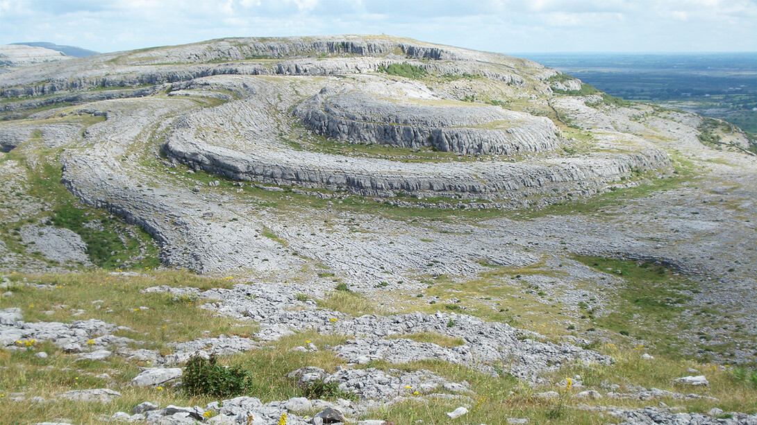
For some of that time, she’ll be making the one-hour drive west from Galway to the Burren, a coastal region boasting roughly 100 square miles of limestone exposed by ancient glaciers that scraped away the overlying shale and sandstone.
The properties of that limestone make it a geologic library of the Earth’s climate history, Frank said. Much of the limestone houses marine fossils whose presence alone can tell researchers about the biodiversity of a given timespan. The skeletons and shells of those sea-dwelling organisms likewise contain limestone with important data of its own.
“Locked inside of those shells is a snapshot of what the oceans were like at the time they were living,” said Frank, the Schultz Chair of Stratigraphy at Nebraska.
That snapshot develops from analyzing the variants, or isotopes, of the elements residing within — mainly carbon and oxygen. Comparing the ratio of carbon-13 to carbon-12, for instance, can help sedimentologists like Frank infer how much carbon dioxide was in the oceans and, by association, the atmosphere. Doing the same with oxygen isotopes can offer insights into water temperature and salinity.
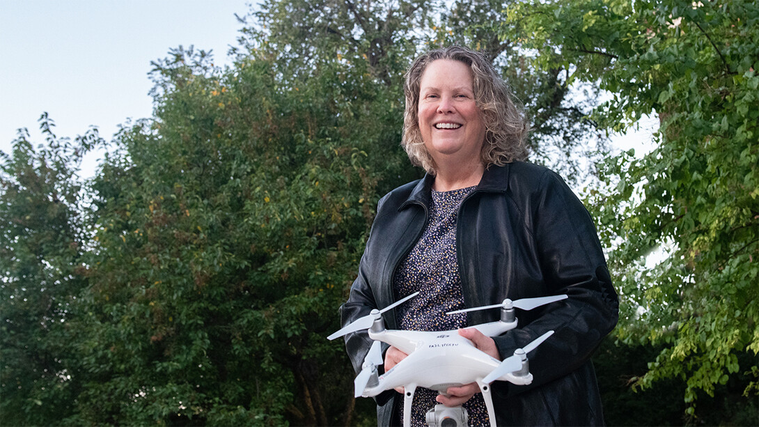
Another, more famous indicator of climate change — sea level — will give Frank the chance to use her drone pilot license. When the Burren’s limestone formed about 350 million years ago, its coast was a tropical sea that reflected a greenhouse climate in which no major ice formations capped the planet’s poles. That greenhouse, though, was giving way to an icehouse climate of glaciers at the poles and eventually even the mid-latitudes. And that 90-million-year series of ice ages, she said, should have fluctuated sea levels.
“When you go into an icehouse period, you expect that signal of sea level going up and down … to start showing up in the rock record,” Frank said. “So there’s also an expression of cyclicity in these rocks, and we’re going to be looking to see how that cyclicity changes through this interval, or if it does.”
With its undulating topography and lack of vegetation revealing rare inland cross-sections of limestone, the Burren rates as an ideal space to search for those sea-level cycles, Frank said. To do it, she’ll pilot a photograph-snapping drone over the region from multiple heights. Frank and colleagues will then feed those photos, and their respective GPS coordinates, into software that can mold the images into a 3D model of the landscape. That model will help the team visualize any layer-based indicators of cyclical changes.
“We should be able to trace a cycle over a huge area, even if it’s not visible from an outcrop,” Frank said. “If we see that cycles developed in one place, are those same cycles present somewhere else, too? If it’s just localized, well, maybe that doesn’t really reflect sea level. But if it’s found throughout the region, that could tell you it does reflect something to do with sea level.”
Collectively, Frank said, the limestone data could help the researchers better understand relationships among greenhouse gases, sea level and polar ice caps that are relevant to modern-day climate change.
“This was the first time in the geologic record that the Earth transitioned into an ice age when it was vegetated, like (it is) today,” she said. “It’s interesting to try to understand how fast that transition occurred; why it occurred; how it might have affected marine communities; how it’s recorded in those limestones. The whole project is focused on trying to read that record.”
‘Places that most people don’t get to see’
This won’t be Frank’s first trip to the Emerald Isle. She first visited a few years ago, when husband Chris Fielding, professor and Coffman Chair of Sedimentary Geology at Nebraska, was traveling there for a conference. And she helped lead a field trip to the country as part of a course on geology-based careers in industry.
This time, she’ll be leading several lectures on mass extinctions at the National University of Ireland, accompanying a field trip to southeast Ireland and visiting the country’s geological survey in Dublin. But Frank said she’ll also be finding time to get away from her research and teaching responsibilities — even if the prospect of driving there makes her a little nervous.
“The area where I’m going has these really narrow roads with really ancient stone walls on either side. It always looks to me like it fits one car going one way,” she said, laughing. “And people drive really fast down those roads. So that’ll take a little getting used to.”
Getting to experience the culture and people for a few months rather than a few weeks should be well worth it, she said.
“I really like seeing how other people live. Being able to take the time to become immersed in that should be really interesting. In fact, the Fulbright people encourage that.
“The thing about geology is that you go to places that most people don’t get to see. You’re not necessarily going to the big cities or the tourist attractions. You’re going off the beaten track, and that’s what I really enjoy.”